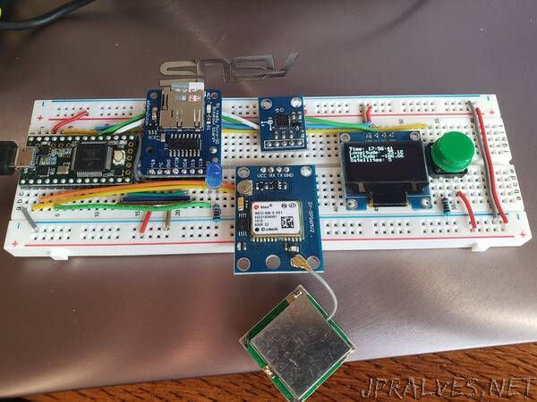
“An accelerometer measure bumps/potholes. These are geo-tagged with a GPS-unit and saved to an uSD card. Visualization via Google Maps.
I teach an Internet of Things workforce development bootcamp (http://deepdivecoding.com/iot) at Central New Mexico Community College. In 10-weeks, this intensive experience, takes individuals with little to no coding / electronics background an prepares them for a career in IoT.
While my students were working on their Capstone projects for our inaugural IoT cohort, I was inspired by Smart City efforts being undertaken by the City of Albuquerque. One of their program statements was that it takes citizen calling in potholes (via their 311 system) for the the city to document the road conditions. They thought of solving this issue by attaching cameras to city-owned vehicles to “map” the conditions of the streets.
While my students were working with various sensors and actuators, it occurred to me that a simple accelerometer could be used to map road quality. By adding in a GPS module and the ability to store geo-location (via a micro-SD card module), the road quality could then be visualized on Google Maps.”
