
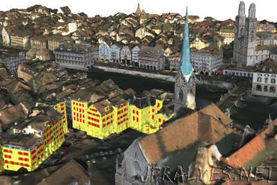
“Dynamic 3D modeling like this could help urban planners design smarter and more livable cities. The city of Zurich, Switzerland has been reconstructed in 3D using millions of images and videos. Developed by researchers at ETH Zurich, the Varcity platform pulls from huge volumes of image data and uses algorithms to automatically stitch it all together. There are millions of images of every major city in the world, many of which are shared openly online. The ETH Zurich team realized they could collect this image data — from standard photos captured by tourists to videos streamed through public webcams and use triangulation to replicate regions in detail. “We combined all sources to provide a complete view of a city,” Hayko Riemenschneider, Varcity project manager, told Digital Trends. “The more data we have of an area, the more precise our models get.””